Ray Stevens MP
Member for Mermaid Beach

Mermaid Beach Electorate

The electorate of Mermaid Beach is a compact urban coastal electorate that covers 29 square kilometres of the central Gold Coast, east of the Pacific Motorway and Robina Parkway.
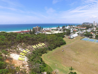
Major Suburbs include Mermaid Beach, Mermaid Waters, Miami, Nobbys Beach, Broadbeach Waters, Robina and Varsity Lakes as well. The electorate includes a large amount of the Gold Coast canal waterways.
The Mermaid Beach Electorate meets up with The Surfers Paradise Electorate to the north; Burleigh Electorate to the South; and Mudgeeraba Electorate to the west with the east boundary meeting the South-Easts coastline. Federally the Mermaid Beach electorate encompasses part of both the McPherson Electorate and Moncrieff Electorate.
The Mermaid Beach Electorate falls within 4 Gold Coast City council divisions; Division 8 which includes the suburbs of Ashmore, Nerang, Carrara, Merrimac, Clear Island Waters and a small part of Robina; Division 10 which includes the suburbs of Benowa, Bundall, Broadbeach Waters, Mermaid Waters, Broadbeach and Mermaid Beach; Division 11 which includes the suburb of Robina, Varsity Lakes and a small area of Burleigh Waters and lastly Division 12 which includes the suburbs of Mermaid Waters, Mermaid Beach, Miami, Burleigh Waters and Burleigh Heads.
Mermaid Beach Electorate at a Glance
Broadbeach Waters
Broadbeach waters is almost completely residential as most properties are adjacent or very close to man-made canals, with the exception of the south east corner of the suburb that hosts the Pacific Fair Shopping Centre. Its northern boundary follows the path of the Nerang River, with surrounding suburbs including Benowa, Bundall, Surfers Paradise, Carrara to the north and north west; Broadbeach to the east, and Clear Island Waters, Mermaid Waters, and Mermaid Beach to the South and south west.
Mermaid Beach
Mermaid Beach is the central suburb of this electorate and is bordered to the west by the artificial canals of adjacent Mermaid Waters to the east by the Pacific Ocean. To the north is the suburb of Broadbeach, and to the south Miami with the Gold Coast Highway running north-south through the electorate. This suburb was originally named for the cutter HMS Mermaid, which in 1823 was sailed aboard by John Oxley when he discovered the nearby Tweed and Brisbane Rivers.
Mermaid Waters
Mermaid Waters is primarily a residential suburb, featuring many homes built along artificial canals and lakes, including the 17-hectare fresh water Lake Hugh Muntz; and like Mermaid Beach is named for cutter HMS Mermaid, which in 1823 was sailed aboard by John Oxley when he discovered the nearby Tweed and Brisbane Rivers. This suburb shares a boundary with Broadbeach, and Broadbeach Waters to the north; Clear Island Waters and Robina to the West; Robina, Varsity Lakes, and Miami to the South; with Mermaid Beach to the East.
Robina
Robina is a master-planned residential community located centrally on the Gold Coast. It is a relatively young suburb with endless facilities. Robina Town Centre is a major shopping centre on the Gold Coast and a central feature of the area. Robina train station is the last stop on the Gold Coast line and is located next to the $160 million Skilled Park, the home of the Gold Coast Titans and a major entertainment facility which can cater for crowds of up to 27,000. Bond University is also located in the area.
Varsity Lakes
Varsity Lakes was originally know as Stephens, but in 2002, Stephens, Andrews and a section of Robina were amalgamated to form the new suburb of Varsity Lakes. The Varsity Lakes name came from a development by Delfin Lend Lease with the man made lakes Lake Orr and Lake Azzura being created as part of this development.